 |
|
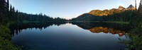
Reflection Lake the other way(jpg)
Google GeoTrack Maps Earth (.kmz) Nearby Pictures
Wed 07/20/16
 |
|
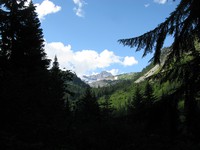
along a trail between a road(jpg)
Google GeoTrack Maps Earth (.kmz) Nearby Pictures
Wed 07/20/16
 |
|
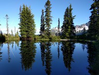
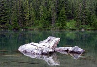
a still surprise(jpg)
Google GeoTrack Maps Earth (.kmz) Nearby Pictures
Wed 07/20/16
 |
|
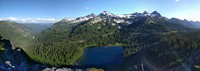
Louise Lake below Pinnacle Peak(jpg)
Google GeoTrack Maps Earth (.kmz) Nearby Pictures
Wed 07/20/16
 |
|
from the depths of Stevens Creek Canyon(jpg)
Google GeoTrack Maps Earth (.kmz) Nearby Pictures
Wed 07/20/16
 |
|
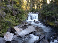
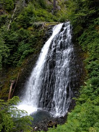
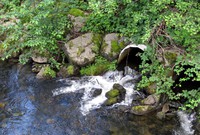
a waterfall on Stevens Creek trail(jpg)
Google GeoTrack Maps Earth (.kmz) Nearby Pictures
Wed 07/20/16
 |
|
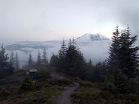
Mt Rainier from Suntop(jpg)
Google GeoTrack Maps Earth (.kmz) Nearby Pictures
Sat 07/16/16
 |
|
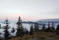
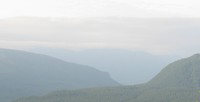
cloudy hills from Suntop(jpg)
Google GeoTrack Maps Earth (.kmz) Nearby Pictures
Sat 07/16/16
 |
|
this meme shall not pass(jpg)
Sat 07/16/16
 |
|
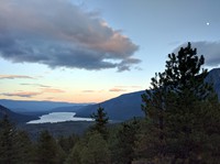
Lake Wenachee from viewpoint(jpg)
Google GeoTrack Maps Earth (.kmz) Nearby Pictures
Fri 07/15/16
 |
|
Lake Wenachee from viewpoint(jpg)
Google GeoTrack Maps Earth (.kmz) Nearby Pictures
Fri 07/15/16
 |
|
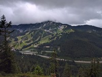
Stevens Pass ski area(jpg)
Google GeoTrack Maps Earth (.kmz) Nearby Pictures
Fri 07/15/16
 |
|
Skyline Lake(jpg)
Google GeoTrack Maps Earth (.kmz) Nearby Pictures
Fri 07/15/16
 |
|
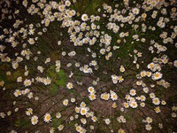
night time daisies(jpg)
Google GeoTrack Maps Earth (.kmz) Nearby Pictures
Fri 07/01/16
 |
|
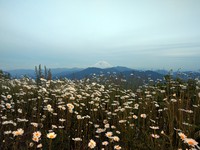
Mt Rainier and daisies from Mt McDonald(jpg)
Google GeoTrack Maps Earth (.kmz) Nearby Pictures
Fri 07/01/16
 |
|
Mt McDonald tower(jpg)
Google GeoTrack Maps Earth (.kmz) Nearby Pictures
Fri 07/01/16
 |
|
Rattlesnake Ledge from Mt McDonald(jpg)
Google GeoTrack Maps Earth (.kmz) Nearby Pictures
Fri 07/01/16
Sugerloaf Mt my arrow(jpg)
Google GeoTrack Maps Earth (.kmz) Nearby Pictures
Fri 07/01/16
Sugarloaf Mt arrow(jpg)
Google GeoTrack Maps Earth (.kmz) Nearby Pictures
Fri 07/01/16
 |
|
Riverbend drain(jpg)
Google GeoTrack Maps Earth (.kmz) Nearby Pictures
Sat 06/25/16