 |
|
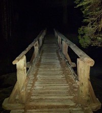
bridge to the night(jpg)
Google GeoTrack Maps Earth (.kmz) Nearby Pictures
Sat 06/04/16
 |
|
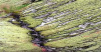
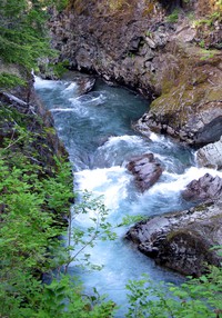
Box Canyon ground(jpg)
Google GeoTrack Maps Earth (.kmz) Nearby Pictures
Sun 07/27/14
 |
|
Box Canyon from above(jpg)
Google GeoTrack Maps Earth (.kmz) Nearby Pictures
Sun 07/27/14
 |
|
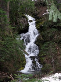
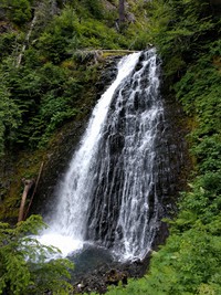
Cowlitz Divide trail Olallie Creek waterfall(jpg)
Google GeoTrack Maps Earth (.kmz) Nearby Pictures
Sat 06/15/13
 |
|
a waterfall on Stevens Creek trail(jpg)
Google GeoTrack Maps Earth (.kmz) Nearby Pictures
Wed 07/20/16
 |
|
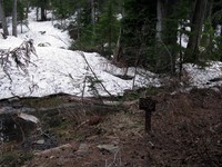
Cowlitz Divide trail Olallie Creek camp sign(jpg)
Google GeoTrack Maps Earth (.kmz) Nearby Pictures
Sat 06/15/13
 |
|
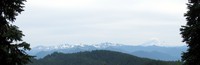
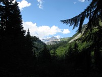
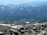
Mount Adams from Cowlitz Divide(jpg)
Google GeoTrack Maps Earth (.kmz) Nearby Pictures
Sun 07/27/14
 |
|
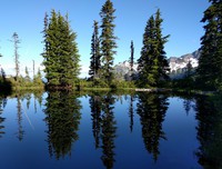
Bench Lake(jpg)
Google GeoTrack Maps Earth (.kmz) Nearby Pictures
Tue 07/26/16
 |
|
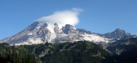
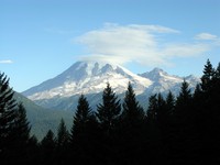
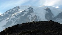
Mt Rainier under cloud(jpg)
Google GeoTrack Maps Earth (.kmz) Nearby Pictures
Sun 08/30/09
 |
|
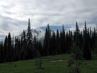
Mount Rainier from Cowlitz Divide(jpg)
Google GeoTrack Maps Earth (.kmz) Nearby Pictures
Sun 07/27/14
 |
|
from the depths of Stevens Creek Canyon(jpg)
Google GeoTrack Maps Earth (.kmz) Nearby Pictures
Wed 07/20/16
 |
|
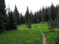
Cowlitz Divide trail(jpg)
Google GeoTrack Maps Earth (.kmz) Nearby Pictures
Sun 07/27/14
 |
|
Mt Rainier under cloud(jpg)
Google GeoTrack Maps Earth (.kmz) Nearby Pictures
Sun 08/30/09
 |
|
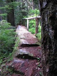
Cowlitz Divide trail log bridge(jpg)
Google GeoTrack Maps Earth (.kmz) Nearby Pictures
Sat 06/15/13
 |
|
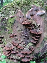
Cowlitz Divide trail fungus(jpg)
Google GeoTrack Maps Earth (.kmz) Nearby Pictures
Sat 06/15/13
 |
|
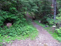
Cowlitz Divide Trailhead(jpg)
Google GeoTrack Maps Earth (.kmz) Nearby Pictures
Sat 06/15/13
 |
|
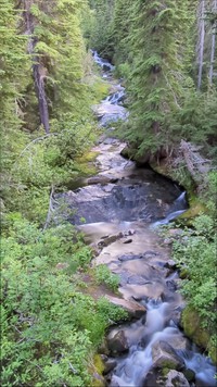
Ohanapecosh River(jpg)
Google GeoTrack Maps Earth (.kmz) Nearby Pictures
Sat 06/21/14
 |
|
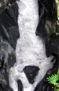
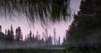
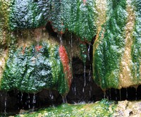
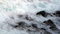
colorful warm water(jpg)
Google GeoTrack Maps Earth (.kmz) Nearby Pictures
Sun 06/01/08
 |
|
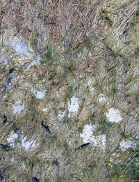
warm water grass(jpg)
Google GeoTrack Maps Earth (.kmz) Nearby Pictures
Sun 06/01/08
 |
|
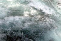
water pattern(jpg)
Google GeoTrack Maps Earth (.kmz) Nearby Pictures
Sun 06/01/08
 |
|
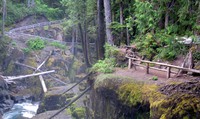
Upper Silver Falls(jpg)
YouTube Video http://www.youtube.com/watch?v=47e8FrlVW2s
Google GeoTrack Maps Earth (.kmz) Nearby Pictures
Sun 06/01/08
 |
|
Laughingwater Falls(jpg)
Google GeoTrack Maps Earth (.kmz) Nearby Pictures
Sat 06/21/14
 |
|
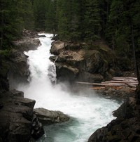
Silver Falls(jpg)
Google GeoTrack Maps Earth (.kmz) Nearby Pictures
Sat 06/21/14
 |
|
Silver Falls(jpg)
Google GeoTrack Maps Earth (.kmz) Nearby Pictures
Sun 06/01/08
 |
|
Silver Falls(jpg)
Google GeoTrack Maps Earth (.kmz) Nearby Pictures
Sat 06/21/14
 |
|
Upper Sunbeam Falls video(jpg)
Google GeoTrack Maps Earth (.kmz) Nearby Pictures
Mon 07/10/23
 |
|
Louise Lake below Pinnacle Peak(jpg)
Google GeoTrack Maps Earth (.kmz) Nearby Pictures
Wed 07/20/16
 |
|
a still surprise(jpg)
Google GeoTrack Maps Earth (.kmz) Nearby Pictures
Wed 07/20/16
 |
|
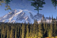
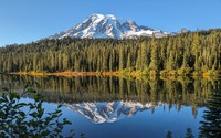
Mt Rainier Reflection Lake(jpg)
Google GeoTrack Maps Earth (.kmz) Nearby Pictures
Sun 08/30/09
 |
|
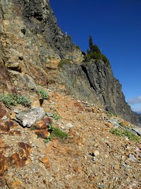
without a sense of balance I think not(jpg)
Google GeoTrack Maps Earth (.kmz) Nearby Pictures
Tue 07/26/16
 |
|
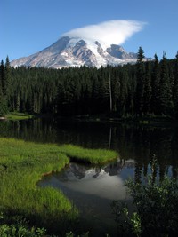
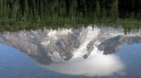
Mt Rainier in Reflection Lake(jpg)
Google GeoTrack Maps Earth (.kmz) Nearby Pictures
Sat 10/07/23
 |
|
Mt Rainier in Reflection Lake(jpg)
Google GeoTrack Maps Earth (.kmz) Nearby Pictures
Sun 08/30/09
 |
|
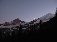
half moon Rainier(jpg)
Google GeoTrack Maps Earth (.kmz) Nearby Pictures
Sat 09/03/11
 |
|
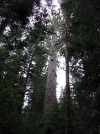
Eastside Trail trees(jpg)
Google GeoTrack Maps Earth (.kmz) Nearby Pictures
Sun 08/25/13
 |
|
Paradise from Camp Muir trail(jpg)
Google GeoTrack Maps Earth (.kmz) Nearby Pictures
Sun 08/30/09
 |
|
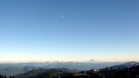
Mt Adams and moon from Frying Pan Gap(jpg)
Google GeoTrack Maps Earth (.kmz) Nearby Pictures
Sat 08/25/12
 |
|
Mt Rainier from above Paradise(jpg)
Google GeoTrack Maps Earth (.kmz) Nearby Pictures
Tue 08/17/10
 |
|
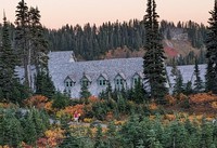
Mt Rainier Lodge(jpg)
Google GeoTrack Maps Earth (.kmz) Nearby Pictures
Sat 10/07/23
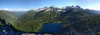
Plummer Peak pano(jpg)
Google GeoTrack Maps Earth (.kmz) Nearby Pictures
Tue 07/26/16
 |
|
Mt Rainier from Reflection Lake(jpg)
Google GeoTrack Maps Earth (.kmz) Nearby Pictures
Sat 10/07/23