Coming back from Sunrise up on Mt. Rainier few weeks ago, I picked up an athletic couple who had just popped out of the woods after some hiking. They said they’d done a loopish trail along a high ridge above the highway not far this side of the park entrance.
They said the trail was something like 14 or 16 miles. I didn’t like the sound of that milage so would have written it off. Except the guy left me their xerox of a map.
 – (Click on the map image a second time to see a big version of it.)
And that map just sat in my “briefcase”. Taking room. Asking me at odd times, “Why not check this trail out?”
Well, today I did.
But, I forgot that they also said, “The map lies.”
Understatement. Perhaps their discription of the trail’s milage and the map and odometer reading on the road should have clued me in. The map has the trail at something a bit over a couple of miles. Maybe even 3 or 4 at the outside.
Reality has a different trail.
But, I didn’t remember that until later. Much later.
Got started so early that I didn’t even check the flashlight before setting off. No way could I be back in the dark today.
Read “The Khaki Boys – Over the Top” or some such boys-book from WWI times on the Palm on the way up. Do they still have war books for boys? Where the heros have stirring adventures and are always eager to get back in the fight? Where everyone around them is getting killed off, but where even if a hero gets blown through the air by a bomb and buried, he’s back fighting in a few days? Where our heros are saving the world for “liberty” against the “beasts”?
No. It seems that the States now fights for “the economy”. Which means a lot of good, important things. But, most of us probably have never really thought what those things are. Those things are probably similar to Dave Berry’s spoof of modern history books, in which every section women and un-white guys do “something important”. And, it’s hard to imagine someone willing to die for what seems like an extra buck an hour. But I digress.
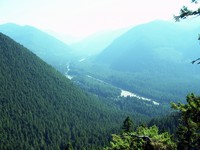
The trail, quite clearly a mountain bike trail, was smooth, regular, and easy to walk. Switched back a bunch going up the Ranger Creek area. The map is correct about that part. Got to the end of the switchbacks. Seemed like a couple of miles, both from distance and from time. Shot the first picture from an off-trail lookout.
Now, according to the map, the cutoff for the dark, black Palisade Trail should have been a tiny distance away from that lookout.
Nope. Not there.
Looked at my watch. Going more slowly than I thought, apparently.
Looked at the terrain.
Hmmm. Looks right.
Where was that cutoff?
What to do?
Down toward the bottom of the hill there was a fork in the trail. I had taken the left one. Maybe the map was off and I should have taken the right one. … No. The terrain says that I’m at the right place. There were, I thought, more switchbacks than the map indicates, but that’s not enough to wonder about.
What to do?
I kept going up the hill, directly away from the road. Long, relatively straight section, matching the map’s description of the trail beyond the hand-written Ranger Peak. I figured “Ranger Peak” was the lookout.
At the east end of this valley, the trail started switchbacks again, just like the map had it. I didn’t like the idea of going up to a logging road and coming down the same trail I came up, but there it was. Nothing much, it seemed, I could do about it.
Got to a “top”. An open-sided cabin! With a dry water pipe coming out of the ground. Lifted it and heard a loud scraping sound. Funny water? No. It was a mountain biker coming down a trail to the cabin skidding to a stop a few feet from me.
He said, “We saw a sign at the top saying, ‘Highway, 7 miles.’ We’ve probably come down 2 miles.”
That seemed about right according to my watch and the Palm’s battery depletion. That put me 5 miles or so up the hill in a couple of hours or so. I was fuzzy on when I had left the car.
And…
At the cabin, there were 3 trails. One, down. That was the trail I had come up. Another, up. That was the trail the bikers (there were 6 by the time I left) had come down. Another was clearly marked as Trail 1198, the Palisades Trail.
But, all logic, terrain and time put us on the Ranger Creek trail just below the “15” on the map. There should be a logging road 1 or 2 hundred yards to the west of us. That didn’t feel right.
Well, perhaps I should have paid attention to the fact that the map also had trail 1167 running under Snoquera Falls. Trail 1167 would be the trail that disappeared under those falls, as I had found out another time when I’d stopped climbing straight up the hill toward the Palisades Trail that, at the time, I didn’t know existed.
Anyway, I was still desperately trying to make the map fit reality. Ah, such a naive belief in the truth of maps.
What to do?
I remembered the couple’s milage figure – roughly. But how could that nice, straight trail possibly be so long?
Several hours answered that question.
The trail is not straight.
In fact, There is one section of the trail that seems to run roughly where the logging road 7250 is. That is, you go out to the 5089 elevation ridge above the highway. Then you come back to cross the creek not far from where 7250 crosses it. Needless to say, it was not cheering to be walking in the opposite direction from where I needed to go … with no end in sight and the sun going down.
In the end, it appears that the real trail, perhaps rebuilt for mountain biking, follows the lay of the land. Always slightly descending. Following the contours from NE to SW and back and forth and back and forth until it piles up those miles.
It was a nice trail. Well drained and smooth, though slightly bowed from bikes.
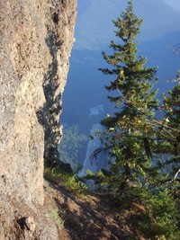
And, it’s always fun to stand on lookouts and stare down, way down, at things like roads and runways.
Runway?!?
Yeah, from the trail, you gotta wonder about that runway. Kinda tight. Not likely to be windy, though, deep in that valley.
So, after the sun had dropped well below the hills, I got to the map’s “Loose Rocks”. Misleading words, those. There are some loose rocks on the trail. But nothing to write home about. Bikers would not like them. But, then, bikers would not like 20 foot wood ladders either. Nor multiple, 30-foot-long switchbacks. And, that’s what you find below “Loose Rocks”. It’s a steep hill.
It was dark at the bottom with the road within hearing. I went along the trail to the Boy Scout Camp. There, I found a sign saying “Ranger Creek 2 1/2”. What! No way. I went down to the road, walked along a trail that follows about 50 feet from the road for a while. Found a trailhead and wondered whether it was the one I left from and the car had been towed off or something. Logic said no. Walked further along the road.
And karma was with me.
A couple of guys in a big pickup with motorbikes in back stopped and asked if I needed a ride. Yep. Even if it was maybe 500 yards. It was worth it. I was dragging. A tiny breakfast and 3 bottles of Gatorade just don’t do it for a hike over 10 miles with plenty of altitude gain.
Should you take this hike?
Why not? Just don’t pay any attention to the map.
And do take it from Ranger to Dalles, SE to NW. Not the other way.
And do it on a day when the mountain is not faded in to the sky. From the ridge you see the top half.
And, maybe you’ll be able to bum a ride back to your wheels when you get back to the highway.


