 |
|
cloudy hill(jpg)
Google GeoTrack Maps Earth (.kmz) Nearby Pictures
Sun 08/26/12
 |
|
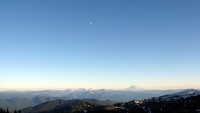
Mt Adams and moon from Frying Pan Gap(jpg)
Google GeoTrack Maps Earth (.kmz) Nearby Pictures
Sat 08/25/12
 |
|
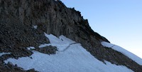
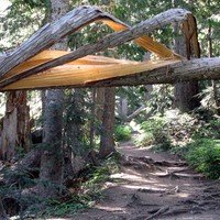
last bit of trail to Frying Pan Gap(jpg)
Google GeoTrack Maps Earth (.kmz) Nearby Pictures
Sat 08/25/12
 |
|
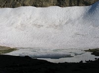
snow and lake below Frying Pan Gap(jpg)
Google GeoTrack Maps Earth (.kmz) Nearby Pictures
Sat 08/25/12
 |
|
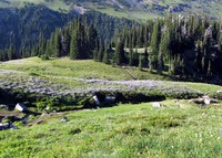
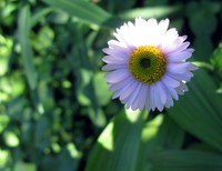
Summerland meadow(jpg)
Google GeoTrack Maps Earth (.kmz) Nearby Pictures
Sat 08/25/12
 |
|
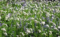
Summerland trail wildflowers(jpg)
Google GeoTrack Maps Earth (.kmz) Nearby Pictures
Sat 08/25/12
 |
|
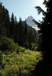
Summerland trail(jpg)
Google GeoTrack Maps Earth (.kmz) Nearby Pictures
Sat 08/25/12
 |
|
on the last steps of the elusive Topcon(jpg)
Google GeoTrack Maps Earth (.kmz) Nearby Pictures
Sat 08/25/12
 |
|
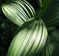
Summerland trail wildflower(jpg)
Google GeoTrack Maps Earth (.kmz) Nearby Pictures
Sat 08/25/12
 |
|
Frying Pan Creek Summerland trail(jpg)
Google GeoTrack Maps Earth (.kmz) Nearby Pictures
Sat 08/25/12
 |
|
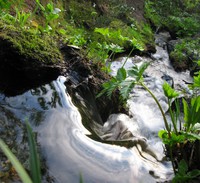
Frying Pan Creek thru the shute(jpg)
Google GeoTrack Maps Earth (.kmz) Nearby Pictures
Sat 08/25/12
 |
|
Frying Pan Creek in August(jpg)
Google GeoTrack Maps Earth (.kmz) Nearby Pictures
Sat 08/25/12
 |
|
tiny stream near Cayuse and Chinook Passes(jpg)
Google GeoTrack Maps Earth (.kmz) Nearby Pictures
Sun 08/05/12
 |
|
Cayuse Pass equipment(jpg)
Google GeoTrack Maps Earth (.kmz) Nearby Pictures
Sun 08/05/12
 |
|
where east side trail crosses the road(jpg)
Google GeoTrack Maps Earth (.kmz) Nearby Pictures
Sun 08/05/12
 |
|
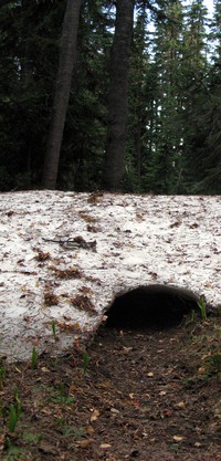
the tunnel is open(jpg)
Google GeoTrack Maps Earth (.kmz) Nearby Pictures
Sun 08/05/12
 |
|
the gate is closed(jpg)
Google GeoTrack Maps Earth (.kmz) Nearby Pictures
Sun 08/05/12
 |
|
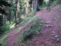
east side trail switchback(jpg)
Google GeoTrack Maps Earth (.kmz) Nearby Pictures
Sun 08/05/12
 |
|
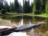
lake above Cayuse Pass(jpg)
Google GeoTrack Maps Earth (.kmz) Nearby Pictures
Sun 08/05/12
 |
|
meadow above Cayuse Pass(jpg)
Google GeoTrack Maps Earth (.kmz) Nearby Pictures
Sun 08/05/12