Tennis, anyone

Someone at Synapse drummed up a tennis tournament. Enough people volunteered that we’re playing doubles. I’m paired with a likely-best player, a new college grad named Kate, who played on her high school team. I’m paired that way, maybe, so that she can compensate for me. I told the guy organizing the thing that I hadn’t played in 30 years.

Oh, so true.

Yesterday, Saturday, I scrounged around trying to find the newer racquet we got to ping with the kids when they were under 10. But it’s gone somewhere. So, it was the old Wilson T2000 for me. Stacked against new racquets, it looks like a badminton racquet. A really heavy badminton racquet. Heck, this thing was called the “steelie”!

GI Joe’s. 3 balls for $2.50. Should I get 4 cans for $8.50? Nah. I’ll never use these things again. And, anyway, I’ve never had more than 3 balls. Heck, the only people with a bucket of balls back in the day were rich, old, serious tennis guys and schools and clubs! What enormous changes there have been with prices of small manufactured goods over the last 30 or 40 years! I suspect that three balls wasn’t much cheaper than $2.50 in 1970. If so, minimum-wage-equivalent pricing would be 10 bucks. Sounds about right.

Anyway, I find out where there are some courts and go there.

4 of ’em at Tibbet’s Park in Issaquah.

The end court has a big, green plywood wall with a white, net-stripe. The wall is stuck up on the high fence that’s around all the courts. A woman and her daughter are using the court with the wall. They take a look at me and say,

“You can use this one if you want.”

“Thanks,” I say.

Well, since the wall is on the far side of the court, I figure I’ll just whack 3 serves to get there.

Toss the ball. Nice toss. Swing. Nice swing. Feeling good.

Whiffff.

Huh?

Toss the ball. Nice toss. Swing. Nice swing. Feeling good.

Whiffff.

Ah…

Toss the ball. Nice toss. Swing. Nice swing. Feeling good.

Whiffff.

Oh, oh. This is not going precisely according to plan.

Whiffff.

Whiffff.

Whiffff.

Oh gosh.

Time for plan B.

The two are looking at me, probably wondering whether I’ll ever hit the ball. I’m wondering that, too.

I explain that it’s been rather a while since I’ve played. Like it’s not obvious, with my whiffed serves and antique racquet.

Up against the wall, Rob.

Whack, whack. The balls going every which way. I’m hitting about half the time on the shaft. Wheee. A ball sails over the fence. Sheesh.

Whack, chase, whack. Whack-chase-whack-chase-whack, weeee. Another homer.

Whack, chase, whack, chase backward, trip. Over on my tail. It’s so pathetic that it’s funny. Hilarious. The only reaction possible. This is slapstick comedy at its broadest.

Whack, whack. Weeee. All balls are outa here, sports fans.

… And, that was the first 3 minutes of my return to the tennis world.

Time and a lot of Gatorade helped. By the end of the afternoon, I was actually getting a few serves in and keeping the ball under control against the wall.

The serves were slow-mo, as expected. No arm strength. No wrist strength. Oh well. Nothing much can be done about that.

So, today, Sunday, I went back for more punishment. Oooo. My arm felt like lead. Oh, to have one of those new, ultra-light racquets. Of course, I can’t borrow one without using a glove. There is no reason to suspect that my weird hand sweat chemistry has changed from the days when a few minutes of grip would deposit a permanent layer of sticky glue. Pity the poor person who tries out the T2000. (It lays in devious wait. Heh, heh.)

But, hey. I did try “playing” an imaginary player who could not return any serve. I lost the second game against him, but creamed him otherwise. So, with a little warm-up, it appears that I can get the serve over, if not accurately to some particular point on the court, and if not particularly fast. That’s good. I’m pleased.

The kicker: Some people were leaving the courts today. “Hey,” says I, “You have some balls here.” (Four balls on the bench.) “Keep ’em,” they say. Apparently, they weren’t worth walking across two courts to get.

I wonder why few people seem to notice this fantastic thing that’s happened. People are worth, now, so much more than things. But, if you “consume” American (European?) media, you’ll learn over and over and over that this is a bad thing. Odd, that.

Blanca Lake

Summer and I saw the nice weather and headed up along Highway 2 past Monroe.

Hmmm. What’s Index? We looked. Tiny town with a cool name.

We kept going up the dead end road past Index, saw a sign about a trailhead, pulled an old trail map book out of the trunk, found the trail description, and thought, “Emerald waters, moderate to difficult, 2700 foot gain” … sounds good.

I gear up. Summer throws her red bag with a loaf of bread, some fake meat, and two small bottles of orange juice on her back, and we take off.

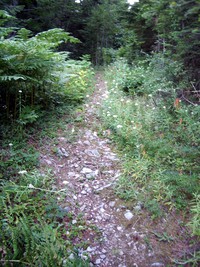
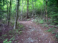
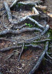
Or, more accurately, Summer takes off with a Youth of America bounce. I stomp after like Godzilla in flippers. Sheesh. Is this kid gonna hit a wall? Answer. No. The trail winds back and forth up a hill. It’s a very nice trail. This picture is not representative, though there are several rootie, Hobbittown looking spots on the trail:

Roots on the Blanca Lake trail

Eventually, the trail passes a little lake called Virgin Lake. Then the trail pops up along a ridge from which you can see Glacier Peak, the Northwest’s least visible volcano. And the top of the ridge is speckled with old peat bogs making artificial looking camp sites.

I found Summer at one of ’em talking with a couple of guys who were camped out. She’d probably been there for about 4 hours, given our speed differences. We all talked for a bit, having fun. Then the bugs got to Summer (“Hey, thanks for coming along. They aren’t bothering me at all.” says her empathetic Dad.), so we trundled on down the trail to Lake Blanca.

If you take this trail, don’t get discouraged when you start down the steep trail to the unseen lake. Yes, you hear water about 10,000 feet below. Yes, it’s a little hard to figure out why you won’t be going to that water. Yes, the lake may seem like it must be about another 4 miles away. But, trust me, it’s not too far.

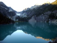
And, the waters are “emerald”. I suppose. Anyway, they are a striking green that does not come through in this picture:

Blanca Lake

The flashlight, as usual, got us out to the car.

Nice hike. Summer figures to come back. The trail is variable, has a lot to offer. We probably hit its best time of the year.

Windows Vista RC 1 Tryout

Since asuka didn’t migrate to the new box easily, that box is sitting on the floor now doing nothing except keep a backup for asuka’s disks as of a couple weeks ago.

Hey, why not download the RC1 version of Vista?

Did – after much trouble with the official download mechanism, simply downloaded a bit-torrent version. Microsoft tells the MD5 and SHA1 of the ISO, so the bit-torrent version can be verified without any trouble. Thank you, DCRC.

Was warned off trying the 64-bit version by various web postings.

Install:

Took a while, unattended, after a couple of simple, basic settings (e.g. Language).

First log on took a long while, too. They try to keep you interested with fading in/out promo notes.

I installed Vista x86, 32-bit in the little 9 gig Linix swap partition. There was some fussing about it not being the right sort of partition, but that was very easy to fix.

The install leaves a very clean directory structure. I like that the users are put under “\users”. Too bad that “\Program Files”, with its embedded space, is pretty much unchangable to “\programs”.

Disk properties says that there remained less than 2 gig, so this DVD image expands out from a compressed image for sure.

Windows networking:

I could map my XP box’s shared drive. I could map the Linux servers’ Samba shares. I could not map any Win98 box’s shared drives.

Desktop:

Transparent windows are confusing, messy, and really don’t bring much to the table, in my view.

There were a couple of gratuitous icons, but they are easily tossed and unobtrusive. Nice.

The gadget toolbar confused me for a bit ’cause I did not even notice its existence until I tried to move the trashcan over the unpopulated part of the gadget toolbar – which was indistinguishable from the desktop background. And, what possible value is there in putting gadgets inside some specialty area? What is wrong with them going anywhere you like on the desktop? Heck, Microsoft seemed to intend to encourage people to create smart icons (“gadgets” seems to be the word the world is converging on for these mini-window programs) quite a few years ago. The tragedy of them is that, as they appear simple, it should be simple to create ’em. A few lines of code in some scripting language (e.g. Python, C#, Java) should get you an “Hello World” gadget. But, I digress.

The windows generally have a cluttered look.

The new minimize-size-close buttons on the upper right are nice. Their mouse-hover glow is a great improvement. And these buttons’ larger size is nice. And the big red close button is superior to the old windows style. Keep in mind that I have always used Windows Classic mode. For all I know XP may already has “fixed” these buttons. Anyway, they are almost, but not quite, as nice as OS/2 was a decade ago. Would that you could put the X in the upper left, away from the sizing buttons.

Vista does a bit of selling something called Windows Live. Like “Dot Net”, Windows Live is something … I’m sure. Yes. Quite sure. And, without question, it must have something to do with Windows. Or something. The red X worked fine in Windows Live. Or something.

The media player tries to sell something called, as Dave Barry would say, I’m not making this up, “Urge.” That’s right. They are trying to sell you a … what? … urinal?

So, that’s the 10 minute look. I may never see Vista again until some machine I get for Windows comes with it.

Overall impression:

Incremental update. Not irritating.

Looks like they are doing as good a job as they can to default-to-secure-mode. Kudos!

They are moving toward trying to make the whole PC experience one that is more like buying a car rather than buying a fixer-upper boat. That’s the proper thing for them to do, of course, given that if you want a fixer-upper boat, your best bet nowadays is Linux. And they are doing a pretty good job of it, it seems.

As the only “car” manufacturer, they are on the uncompetitive slow-road. Since their disasterous decision not to split the company in to pieces, it’s a safe bet that they will plod on relatively successfully, but gradually downhill for many years to come. That “many years” could be shorter than anyone would imagine if certain machines ever take off:

  • “Audrey” type machines (cheap, throw-away, distributed-around-the-home appliances with built-in web browsing)
  • smart-phones that can drive any neighboring screen and keyboard/mouse.

But, that’s another subject.

Birth Memories

Read an article, Why can’t I remember my own birth?, at The Register.

So, it’s time to put this rather fun thing down somewhere.

From a very young age I occasionally had a particular nightmare. Sometimes I had a form of it while awake – often when I was feverish with some childhood ill. I called it a “daymare”.

At around 10 or 11 I “got control” of it. I was awake (skipping school and not feeling well and laying in bed) when I had some of the daymare. That day, perhaps because I was old enough or experienced enough with the thing, I found that I could turn it on and off and even play a bit with its intensity. That was quite an experience for me, as it had been very scary for as many years as I could remember (and I had a very good memory of being young – back to 2, at least).

What’s that all got to do with birth memories?

Here is how I described the main part of the daymare at the time: “I’m going through square rollers.”

So, what are “square rollers”?

Well, first, by the age of 10 (and younger), I knew that these nightmare rollers were physically impossible. But “square rollers” was the best I could do for a word. “Square rollers” are like kitchen dough rollers, but not like them.

First, imagine you are lying on a Roller ConveyorRoller Conveyor. Now, imagine that the rollers are powered. They are moving you along. Head first. Not fast. Now, imagine that you are not simply lying on them, they are above and below you and on your sides. Rolling you along. You have no sense of gravity.

Got that?

Now, imagine that the round rollers don’t seem to individually move continuously down your body. Instead, they press almost like the corner of a square in to you, pushing you along. As you move relative to them, the corners become the flat sides of the square. That is, you are not pressed by an edge, but instead by a flat surface. Same pressure. Just not as sharp. Then, lower on your body, you feel the corner again. But the flat parts overlap with the corners in some strange way. And the corners are not sharp, like they must be. That part is hard to put in to words. They are sharp, but in a different way than a sharp corner of a square. Duller, but not duller. It’s sort of like when you misinterpret something out of the corner of your eye. That is, if you don’t pay too close attention to a particular corner, it feels sharp. But, if you really take notice of that corner, it just isn’t quite as sharp feeling.

Got that?

Well, again, at 10 and younger, the only rollers I knew about were kitchen dough rollers. They were the right relative size, but they had some problems:

1) They did not conform to the shape of a body. The nightmare rollers did. For example, I could feel the same pressure from the “corner” of a square roller all across my body, high points and low, and around on the sides.

2) A kitchen roller is too round.

3) If they were square, they would not be able to turn. They were close enough that they would knock against each other. They would need to mesh like gears. But, I knew that such gears would counter-rotate in pairs. These rollers did not.

The rollers were not painful. But there’s no question they were doing some serious squeezing.

By the way, the rollers covered the whole body, head to toe. I could not help wondering how I could breath. But I had no sense of lack of breath.

The daymare had an extra component not in the nightmare: If I had my eyes open, the corner of the room would recede, like I was moving closer to the floor or shrinking or the room was expanding. That was the part I could adjust on that day at year 10 or so. I could move the corner of the room toward me and away. And, I could put the rollers on and take them off, so to speak.

From that day, the nightmares were no longer scary. I had them, but they just didn’t have the power they had had. In fact, they were kind of fun. For several years I’d play with them when I was not feeling well, or when I just felt like it. I could pretty easily do the room-corner thing while feeling the square rollers through my 20’s. After that time, I had kids and could not be sick any more. Now, all of this is a memory of a memory to me.

So, back to the subject of birth memories.

Sometime in my early 20’s I realized that the whole thing was a birth memory. Muscles can feel like the square rollers. And, it’s hard to imagine that one-way trip down the vagina as feeling anything but exactly what the nightmare felt like.

I’d need to search through a lot of old private writings to find out exactly when that realization came to me. I think it was a couple years before (and this is related to some of the text of the Register article), at age 24, I realized that people exist who think in words.

But that’s another story.

Palisades Trail from Ranger Creek to Dalles Creek

Coming back from Sunrise up on Mt. Rainier few weeks ago, I picked up an athletic couple who had just popped out of the woods after some hiking. They said they’d done a loopish trail along a high ridge above the highway not far this side of the park entrance.

They said the trail was something like 14 or 16 miles. I didn’t like the sound of that milage so would have written it off. Except the guy left me their xerox of a map.

Inaccurate Palisades Trail map – (Click on the map image a second time to see a big version of it.)

And that map just sat in my “briefcase”. Taking room. Asking me at odd times, “Why not check this trail out?”

Well, today I did.

But, I forgot that they also said, “The map lies.”

Understatement. Perhaps their discription of the trail’s milage and the map and odometer reading on the road should have clued me in. The map has the trail at something a bit over a couple of miles. Maybe even 3 or 4 at the outside.

Reality has a different trail.

But, I didn’t remember that until later. Much later.

Got started so early that I didn’t even check the flashlight before setting off. No way could I be back in the dark today.

Read “The Khaki Boys – Over the Top” or some such boys-book from WWI times on the Palm on the way up. Do they still have war books for boys? Where the heros have stirring adventures and are always eager to get back in the fight? Where everyone around them is getting killed off, but where even if a hero gets blown through the air by a bomb and buried, he’s back fighting in a few days? Where our heros are saving the world for “liberty” against the “beasts”?

No. It seems that the States now fights for “the economy”. Which means a lot of good, important things. But, most of us probably have never really thought what those things are. Those things are probably similar to Dave Berry’s spoof of modern history books, in which every section women and un-white guys do “something important”. And, it’s hard to imagine someone willing to die for what seems like an extra buck an hour. But I digress.

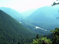
The trail, quite clearly a mountain bike trail, was smooth, regular, and easy to walk. Switched back a bunch going up the Ranger Creek area. The map is correct about that part. Got to the end of the switchbacks. Seemed like a couple of miles, both from distance and from time. Shot the first picture from an off-trail lookout.

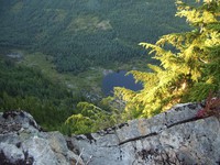
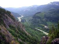
Looking up White River valley from Palisades Peak

Now, according to the map, the cutoff for the dark, black Palisade Trail should have been a tiny distance away from that lookout.

Nope. Not there.

Looked at my watch. Going more slowly than I thought, apparently.

Looked at the terrain.

Hmmm. Looks right.

Where was that cutoff?

What to do?

Down toward the bottom of the hill there was a fork in the trail. I had taken the left one. Maybe the map was off and I should have taken the right one. … No. The terrain says that I’m at the right place. There were, I thought, more switchbacks than the map indicates, but that’s not enough to wonder about.

What to do?

I kept going up the hill, directly away from the road. Long, relatively straight section, matching the map’s description of the trail beyond the hand-written Ranger Peak. I figured “Ranger Peak” was the lookout.

At the east end of this valley, the trail started switchbacks again, just like the map had it. I didn’t like the idea of going up to a logging road and coming down the same trail I came up, but there it was. Nothing much, it seemed, I could do about it.

Got to a “top”. An open-sided cabin! With a dry water pipe coming out of the ground. Lifted it and heard a loud scraping sound. Funny water? No. It was a mountain biker coming down a trail to the cabin skidding to a stop a few feet from me.

He said, “We saw a sign at the top saying, ‘Highway, 7 miles.’ We’ve probably come down 2 miles.”

That seemed about right according to my watch and the Palm’s battery depletion. That put me 5 miles or so up the hill in a couple of hours or so. I was fuzzy on when I had left the car.

And…

At the cabin, there were 3 trails. One, down. That was the trail I had come up. Another, up. That was the trail the bikers (there were 6 by the time I left) had come down. Another was clearly marked as Trail 1198, the Palisades Trail.

But, all logic, terrain and time put us on the Ranger Creek trail just below the “15” on the map. There should be a logging road 1 or 2 hundred yards to the west of us. That didn’t feel right.

Well, perhaps I should have paid attention to the fact that the map also had trail 1167 running under Snoquera Falls. Trail 1167 would be the trail that disappeared under those falls, as I had found out another time when I’d stopped climbing straight up the hill toward the Palisades Trail that, at the time, I didn’t know existed.

Anyway, I was still desperately trying to make the map fit reality. Ah, such a naive belief in the truth of maps.

What to do?

I remembered the couple’s milage figure – roughly. But how could that nice, straight trail possibly be so long?

Several hours answered that question.

The trail is not straight.

In fact, There is one section of the trail that seems to run roughly where the logging road 7250 is. That is, you go out to the 5089 elevation ridge above the highway. Then you come back to cross the creek not far from where 7250 crosses it. Needless to say, it was not cheering to be walking in the opposite direction from where I needed to go … with no end in sight and the sun going down.

In the end, it appears that the real trail, perhaps rebuilt for mountain biking, follows the lay of the land. Always slightly descending. Following the contours from NE to SW and back and forth and back and forth until it piles up those miles.

It was a nice trail. Well drained and smooth, though slightly bowed from bikes.

And, it’s always fun to stand on lookouts and stare down, way down, at things like roads and runways.

Runway?!?

It'll take Sky King and his niece Penny to land here!

Yeah, from the trail, you gotta wonder about that runway. Kinda tight. Not likely to be windy, though, deep in that valley.

So, after the sun had dropped well below the hills, I got to the map’s “Loose Rocks”. Misleading words, those. There are some loose rocks on the trail. But nothing to write home about. Bikers would not like them. But, then, bikers would not like 20 foot wood ladders either. Nor multiple, 30-foot-long switchbacks. And, that’s what you find below “Loose Rocks”. It’s a steep hill.

It was dark at the bottom with the road within hearing. I went along the trail to the Boy Scout Camp. There, I found a sign saying “Ranger Creek 2 1/2”. What! No way. I went down to the road, walked along a trail that follows about 50 feet from the road for a while. Found a trailhead and wondered whether it was the one I left from and the car had been towed off or something. Logic said no. Walked further along the road.

And karma was with me.

A couple of guys in a big pickup with motorbikes in back stopped and asked if I needed a ride. Yep. Even if it was maybe 500 yards. It was worth it. I was dragging. A tiny breakfast and 3 bottles of Gatorade just don’t do it for a hike over 10 miles with plenty of altitude gain.

Should you take this hike?

Why not? Just don’t pay any attention to the map.

And do take it from Ranger to Dalles, SE to NW. Not the other way.

And do it on a day when the mountain is not faded in to the sky. From the ridge you see the top half.

And, maybe you’ll be able to bum a ride back to your wheels when you get back to the highway.

Dirty Harry’ Peak

Well, I suppose that it’s ’cause the trail is not far to get to that I keep coming back to it.

First thing: This is not a particularly good trail. It’s in the Mt. Si class of trails going up. Boring, really. Not much to see. One or two little lookouts far above I-90 on the way up. It’s about 45 minutes to the cutoff to the Balcony (if you’re reading an eBook on your Palm). And, another 45 minutes to a fork in the trail.

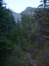
At the fork you can keep going straight to the east or you can switch back over the soggy ground and continue up the relatively steep trail to the west. This picture was taken pointing level, so you see that it’s a relatively steep trail.

Dirty Harry's Peak trail

The last hike before this weekend I’d continued east. Turned around from lack of sun. Good thing.

Yesterday, Saturday, I left much earlier and kept at it. And at it. Up above a little lake. The “trail” eventually peters out below the last section of rock near the top of a series of hill tops making the trail’s bowl to their west. In a rare state of reasonableness I looked up at the last few hundred vertical feet and said, “What am I doing here? If I get to the top of this thing, I’ll want to go along the ridge to the top of the highest of these peaks. Why?”

It was a hard question to answer.

I headed down.

But not without first eyeing the east end of Mailbox Peak and wondering, “Hmmm. Would it make some kind of sense to go overland to Mailbox. Then go down the Mailbox trail and hustle a ride back to the car?”

Luckily, it did not.

And I did not head down the northern side of all this stuff to Granite Lake where I figured I could pick up the old logging road leading down to the Middle Fork of Snoqualmie road. And bum a ride back to the car.

That “old logging road” is the one that goes up to the stange little building atop a mountain, the “Our welcome mat is always out for you” building. From the side of the hill I was on, I could not see that building, btw.

Anyway, Saturday I was low on Costco Sport Drink and hadn’t eaten much breakfast. End of hike.

Sunday: Oh, what the heck. Let’s see what’s to the left at the fork.

Apparently, what’s to the left is a long haul up to a hill that may or may not be named Dirty Harry’s Peak.

Getting to the bottom line: I read a book.

But, after slogging to the top, I found too very nice feelies:

  1. Coming around a bend near the top I looked directly across at the “our welcome mat is always out for you” … whatever it is.

    Strange building at the top of a mountain at the end of a logging road

  2. At the top you walk up through some scrub trees and, if you’re reading your eBook too intently, you can take a big step down. Just about staight down in to Granite Lake. Nice drop.

    Strange building at the top of a mountain at the end of a logging road

And, at the top you’ll find that you can’t easily zing over to the east end of Mailbox. There’s this little 100 foot drop to deal with. You could always skirt around below the hill top. Or you could bring a rope, double it around a tree or something and rappel down. But, why? Anyway, maybe someday I’ll take the old, old logging road up from Granite Lake and then sort of bush-whack to the top of Mailbox from the north side. Seems like it would be kinda fun. Maybe surprise someone there. “Oh, just passing through.”

So, this weekend was all Dirty Harry.

I suspect that I won’t be back.

Want a view that’s close-in? Rattlesnake Ledge.

And, if you insist upon doing Mt. Si, take the trail up from Little Si. It’s not marked, but you can feel your way off the Little Si trail to go up the main hill. It’s the only way to go up Mount Si. The main trail feels (to me coming down in the dark, twice now) raggedy and over-trodden and meandering. The trail up from Little Si softly and quickly goes up through a steep forest. Pleasant.

Dirty Harry’s Balcony Again

Left late. Getting toward 8pm at the trailhead.

Went left at the cutoff, which is maybe 45 minutes to an hour up from the car parked outside the gate. I normally walk at about 3 mph, but not particularly fast up hills. Going up, I simply shorten the steps, gearing down. So, if you walk slow, the cutoff will be an hour and a half up the hill. If you really crank, you could probably get there in a half hour.

Picture of the cutoff:

Cutoff from the mail trail to Dirty Harry's Balcony

So, taking that left turn, the trail leads up for a while on the same kind of stuff. Looks like a very, very old, simple logging road long gone bad from water running down it. Or sorta like the ground over a cable run. It’s not that, though. Not straight enough. To see what such ground looks like, drop off I90 at Highpoint just east of Issaquah and park outside the gate. Look around on the hill side of the road. You’ll find a trail leading straight up the hill all the way to the microwave towers. The key thing is “straight”. Incidently, that “trail” is the quickest way down from north Tiger Mountain. But it’s an unpleasant way to go up.

Anyway, back to the DHB trail: It goes up at a pretty fair clip. This time in June, there was still some water running on it. Nice to have the waterproof boots, but not enough water to be any problem for tennies. About double the distance to the cutoff from the road, there is a fork in the trail. The watery, rocky old-road trail cuts back to the left (west) while a more inviting trail continues up to the right. I took the east/right one. Above this fork, there is a large field of rocks such as are common on the I90 corridor hills. So, it looks like one fork goes around the rocks to the west, and the other to the east. Again, I stayed the course by going east.

After a while, the trail simply stops being the sort of trail it’s been since the road. It cuts to the left and climbs straight up an embankment in to the trees. Ooops. Here we are, back in the sort of area that I can lose a trail in. And, it’s starting to get dark. Oh well. Such is life.

So I zoom up this new section of trail. The whole trail is rather interesting in that it looks like it must get some traffic. It’s not overgrown. Odd, that, because the best thing about this whole trail is that it also has the feel of a trail where you’ll not see anyone else.

The treey section of trail keeps straight up the hill. After a while, there are some respites from the grind. In fact, below the top of a rocky hill, the trail heads back in to a sort of rocky bowl.


Somewhere above Dirty Harry's Balcony in a rocky bowl

Eventually, the trail hits the rocks.

Which was a problem for me, given the time and light. There is one stack of rocks to indicate where to go across the rocks. I crossed one field. Then, all I could see were a couple of orange tags above me in the next rock field. Given that I’d not be able to see them in a few minutes, it seemed like a good idea to guzzle some drink and call it a day. Unsatisfying, that. Almost to the top of something, but forced to turn around.

Good thing I did. Only got off the trail a couple of minor times on the way back to the water-course / old-road-ish trail. Lucky for me that someone scraped the trail in many places to make it blacker and clearer. Whoever it was, must have done it very, very recently. Some brilliant woodsman, no doubt.

When I got to the Balcony cutoff, I thought: why not go up and watch I90 and contemplate life? 350 paces up led to contemplation point, so to speak. It was a nice contrast with the day’s daydream. The daydream for this hike was one I do now and then on trails in the I90 corridor: almost all humans suddenly die from some cosmic didease of something. Think Charlton Heston in the Omega man, without the zombies. It’s a good daydream for the I90 corridor, ’cause it makes the intense polluted waterfall sound of the freeway more bearable.

Back, under the moonless sky, Big Dipper grandly overhead through the trees.

More Expected Characters

Now, it’s expected words.

Or, more exactly, after running the Buffet letters through a program that tracks strings of words (rather than characters), the last of a sequence of letters is shown with the words that are in common strings made small. And unusual words or strings of words are made big.

Common strings are small - uncommon strings are big

The effect is the same. Boiler plate paragraphs are small. New stuff is big.

Dirty Harry’s Balcony

Grey day. But, on the little Timber Trail up at the top of Highway 18 on Tiger Moutain, someone told me about the trail to Dirty Harry’s Balcony.

I’d wondered whether you could get to the top of any of the rock outcrops on the north side of I90 just east of North Bend.

Sure ’nuff.

Turns out, you take Exit 38, the 1st exit east of North Bend. You gotta drive on the old road east a bit past a state park, then under the freeway. Then stop. There, you either go back on I90 westbound, or you take the neat little road up and around to the fire department training grounds. The sign says that they close the gate at 4pm. It’s 5 when I cruise in. Gate’s open.

I explore the road. Small signs along the way. E.g “Pick you heros carefully.” “You own your reaction.” Even without the occasional full sized pickups and anonymous fleet vans, you can guess that this road leads to a world where they play for keeps.

See the trailhead. Measure the distance back to outside the gate. 0.6 miles. Ok. Park outside the gate, stroll back up the road, across the little bridge, up the hill to the trailhead:

Google Maps Note: Google Earth has a much better picture and a Google Earth Community link to the trailhead.


Dirty Harry's Balcony Trailhead

The trail is not a big thing. Just cuts off from the road – not as I think (apparently without a cap) straight back north toward Mailbox Peak, but rather, east up a steady, but unsteep slope.


Closer view of trail as it cuts off the road

Anyway, the trail is one of these straight-up-the-wash things. Kinda rocky. OK, though. Eventually, it hangs a Louie. That’s where the cutoff is for the Balcony. There is a little coil of that 1-inch, rusted, stranded cable you see so often in the woods. And, someone put a little streamer on a bush.

I try to take a picture of the cutoff, but the batteries are dead. … Yank the spares out. … Ooops. They don’t even light up the camera to tell me the battery is dead. What a drag. That means I’ll have to come back sometime to shoot the rest of the trail’s sights. Well, that’s ok, ’cause the left turn has me wondering. Is it another way to get up Mailbox? That’d be quite cool. Go up from I90. Go down the other side to the road/trail up to Granite Lakes. Miss the main trail completely. A real gonzo path, that would be.

Anyway, I take the cutoff and in a few hundred yards of some up, some down, last up, pop out on the Balcony. Top of the rocks, looking at a swirly I90 going east. (The depleted batteries spring back to life for a couple of pictures.)


View from Dirty Harry's Balcony over I90

And, looking back up the rocks toward the east end of MailBox Peak:


View up toward Mailbox Peak from Dirty Harry's Balcony

It’s a bit humid. Close to the low clouds. And, I’ve run out of Kirkland Sport Drink so there’s no reason to linger. I head back.

A bit back on the trail – maybe 50 to 100 yards – there’s a cutoff to the east. Someone has put a branch over the cutoff trail to indicate that it’s the wrong trail. Coming up the trail, the right hand trail turns and goes up to the rocks. The right-turn trail feels right. But, the blocked trail looks interesting. Maybe it goes over to more of the rocks to the east. Let’s see.

I follow it. It’s a real trail. Not a freeway. Looks like maybe it’s a trail used by rock climbers. Up, down, up, up. Ladies, leave your high heels at home. This trail feels very nice.

Eventually, it comes out in one of those open groves of ceders and such. You know the kind. Lots of needles and brown stuff all over. No undergrowth. The trail could be just about anywhere, since the whole area is walkable. I’m thinking, “Hmmm. If this ends up being a longer trail than I’ve planned, I could be coming back here under the LED light.” That’s not good. Even in the best of times, I tend to wander off trails – accidentally or on purpose. Makes no difference. And, I know from harsh experience that I have a real hard time keeping to vague trails running through areas like this open area – in the light. In the dark, it’s random walk time.

Oh well. Getting off the trail isn’t a worry until later.

“Later” is in 2 minutes. The trail came from the upper left area of the grove and, according to my best estimate, peters out somewhere in the upper right area of the grove. What to do? Go back? By Jove, surely you jest!

There are two alternatives:

  1. Go to the edge of the open area and look for where the trail leaves.
  2. Start heading down.

It’s a cinch that the trail goes out of the area about 50 feet from where I am, so alternative 1 is the clear choice.

I choose 2.

Why? Well, if I go with 1, then I’ll pick up the trail, continue along it, and maybe, in about 11-teen miles, get to some other trail from I90. Hungry. Thirsty. Tired. A long way from the car. … Or, I’ll need to come back on this trail – and get lost in the clear grove.

If I go with 2, then I have a chance to come down off the hill in a completely different way than how I got up.

Down we go.

After all, in this kind of forest, the going is pretty good. No brambles to whack through.

I follow it down. … And down. … And down. … Oh, oh. Climbing back out of this thing is not an appealing prospect.

So, down we go some more.

Ah, I hear a stream. Good. Worst case, I can always follow the stream down to I90. Unless it goes over a waterfall. Then I’ll need to improvise.

Well, luck stays with the innocent.

Sure, it’s steady going through moss-on-rock-and-rotten-wood. And, sure, it’s one of those places where there is always a much clearer path about 20 to 50 feet to the left – or right – either one. Take your pick. They both look better than the raggity place you’re in.

Sure, after a couple of slips, I’m glad that I’m wearing old jeans rather than the nice, white pants I so often wear hiking.

No Tarzaning to be done, no vertical stuff, just easy going.

And, you can’t get lost on a steep hill aimed at the sound of Interstate Waterfall.

Score! No brambles at the bottom. Old, old road, completely overgrown by wildflowers. Little building of some sort connected to the shoulder of I90 by a dirt “road”.

Dang. No old road back to the car. Walking on freeways is no fun. Loud. Loud. And, gosh, cars really boogie along nowadays. Not like when we were kids.

And, woe is me:

Exit 38
1 Mile

That’s when I realize that my thinking about the direction of the main trail had been wrong. It was a long trudge back. Soaked pants and shirt from the mist and wet grass.

And, the Gold Honda has “emergency” clothes. So, I step in to ’em in under a light June rain.

The gate was still open at 7:30 as I drove away.

All in all, if you gotta dig in to your emergency gear, it’s been a great walk.