Two New Earth-Like Planets Discovered

While the rest of the world was sleeping, I have been building a space ship. This autonomous ship has recently explored space near our Sun at a distance of Earth’s orbit. This exploration has been a remarkable success.

The ship has discovered two new planets! These planets orbit our Sun in exactly Earth’s orbit. And, it appears they can host life.

You may be skeptical of these claims. That’s understandable. But, pictures don’t lie. I dub the first planet discovered, Oceania. Behold:

The newly discovered planet, Oceania.

Oceania is an ideal planet for fish.

I dub the other newly discovered planet, Landia. Terrestrial animals and plants will find Landia an ideal planet, as you can see clearly:

The newly discovered planet, Landia.

These discoveries promise to change the course of not only history, but of life on Earth, itself.

Drive the World – A Five Day Binge

Have you ever wondered what driving in Lesotho is like?

Me neither.

But now I can say, without having been there, it’s a lot like the altiplano.

You know the altiplano. Well above tree level and not a thing to see after the first glance. But curiously entrancing. People live at this altitude? Well, with lots of thick wool and really red blood … apparently.

Or go a little north to Botswana. Mad Max country. The Australian out-outback. English on the wrong side of the road and miles a miles of … miles and miles.

Dropped to these places by spaceship without knowing where you are? How do you find yourself?

In Holland, such questions are answered immediately. The Dutch apparently even label their bus stops with unique names, available for decoding 24×7 through Google’s super-computer. As are the names of little Estonian villages, in case the spaceship dropped you there.

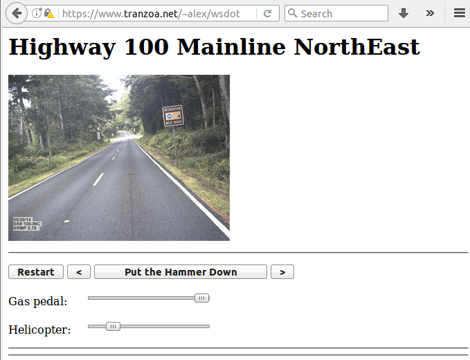
The spaceship is at MapCrunch

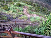
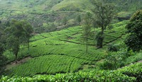
Click on “Options” and check “Stealth”. Then make sure all the countries are either highlighted or none of them are. Toggle “Options” off. Punch “Go”. Welcome to somewhere in the world’s farmland as shown in Google’s Street View.

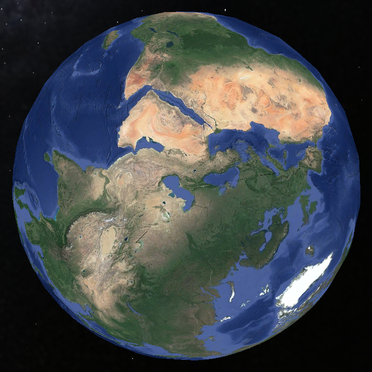
Right now, click maps.google.com and click on the street view thingee down in the lower right. It toggles showing where street view covers. Zoom a bit in and you’ll see where the real coverage is. Germany, Austria, India, and China have only isolated 360° images. They are not street-viewed.

Apparently, a popular MapCrunch challenge is to get from your drop point to an airport for a flight home. No outside help. No Googling. No other Internet tools. Just drive and look. I can advise you not to accept this challenge. Airports are few and far between and driving even 30 miles is really, really slow and RSI inducing (make the window small for fast refreshes). Maybe it would be better to just drive to somewhere you can get some food. Restaurant or store or whatever.

I binged for several days on an alternate game: Figure out exactly where you are using outside help. This game can still be slow. You can open the real Google Maps Street View in another window and find the location you’re at by matching the cloud pattern in the sky. Desperate times call for desperate measures. When you’re cruising south on some road in scrub-land Bolivia, not a town in sight, you gotta do something.

http://www.lexilogos.com/keyboard/russian_conversion.htm is very helpful when you’re in Cyrillic-land and don’t have a Cyrillic keyboard.

You’ll want Flag Finder for when you just arrive and see a rural police station’s flag.

Which way to go at the start? Down hill.

Is the sun north or south? You’re below or above the equator. If it’s to the west, consider driving the same direction as the Google car. He’s headed home for the day.

Satellite dishes point to the sky above the equator.

Driving on the left narrows things down.

The script in signs can peg the country. Korean is easy to spot, for instance.

Signs may be in indecipherable script, but URLs are on those signs. URLs have country codes.

You may even find LAT/LON values on signs. My little LAT/LON interpreter is handy to get to those locations.

Mileposts are give-aways. They have the highway number and, usually, a kilometer-to-some-town/bridge/landmark on them. Go to the direction of the lowest kilometer number when first orienting.


After a while, some things stand out:

New roads. New houses. New factories (P&G in countryside Romania). All over the world.

Cell phone towers everywhere.

Contrasts: Bleak, bedraggled Bulgaria and Kyrgyzstan. Sunny Albania. Thriving Slovakia and Serbia.

Deep red dirt of Uganda.

Frosted Polish trees.

Rebar sticking out of Latin American buildings.

Concrete of the tropics.

Pristine Scandinavian buildings. Red.

Road signs with weirdly chosen destinations. Why is that town on this sign?

Highway numbers that make little sense. But are still able to be found in a Maps window overlooking the country.

Many, many one lane roads, indistinguishable from American bike trails.

If your body has some miles on the odometer, play this game: Erase cell phones and scale the car quality back. What year in America are you looking at? Countryside Panama in 2010 looked like the ’50’s to me.

Ignore country-specific things like languages, zoning laws and building style. Notice the big differences you see between places in the world are rural/urban, not country/country. Cities look the same everywhere. Same stores. Same brands. Same way things are built. Houses are built for the climate and culture. American houses are surrounded by toy farms, for instance. We call them “lawns”. Other places have their oddities. Walls around the house, for instance, are common.

Notice you can’t peg a location by the highway, itself. Yes, guard rails and such do vary, but the road engineers of the world seem to be in close contact. New roads are especially generic. I was sure I’d hit Nevada when I dropped in on a desert highway in Botswana. It took a couple trucks going by (“Anderson Trucking”) before I noticed they were on the wrong side of the road. … The road, whose lines and signs were clearly ‘merican.

In case you think it’s just a couple of odd, Brit holdovers who drive on the left, what with #1 and #3, China and US being right-siders, consider #2 and #4, India and Indonesia on the left.


Final advice: Don’t binge on this thing. After a 34 hour session, I slept fitfully with more than a little pain and porcelain throne facing for 22 hours. And then wrote this advice.

Little Hike in the Rain

In Ella, the big deals are things like a hill, a couple waterfalls, a tea factory.

I took a day to see a hill.

And got watered down while in the usual location: Off the trail.

It seems Costco’s nice, waterproof hiking shoes may not be completely waterproof. But, then, every shoe has a large hole at the top. Such holes in mine may have been a factor. Since I was pushing through thick, chest-high grass on a steep hillside, some of the water the shoes are so liberally soaked with even now, 12 hours later, may, just may, have leaked in fairly. And only one, big finger-cut on the grass, so not much blood to clean off. It was a very short hike, but a complete success.

I wonder what happened to the dog.

dog on little Adam's Peak

In a new place, one can notice separate worlds sharing a space, but only vaguely connected. In Sri Lanka, there are such human worlds. But a couple others become invisible wallpaper if you’re not careful.

Little dogs in the road. Lots of little dogs. Often sleeping. Oddly, with no apparent effort, avoiding being run over.

Little monkeys on roofs, wires and trees. Running around like feral kids. Apparently, they cause some damage. Pull apart roofing to get to food. Sneak in through windows to get to food. What happens to them when they can’t jump from power wire to tree?

Adam’s Peak – Sri Pada Temple

The hill country in Sri Lanka is webbed with roads curling around steep hills. Eventually, modern roads will be put in and trips that take a couple hours now will take a few minutes. Driving roads scaled to long English coastline fractal dimensions at speeds approaching 25 kilometers per hour – notice I didn’t say on which side those speeds are “approaching” – makes short trips complex experiences.

Above those hills looms a stand-alone hill that, in another place would be called “Dragon’s Tooth”. It’s English name is “Adam’s Peak”. Referring to the first dude.

Adam's Peak from afar Adam's Peak from underneath

Adam's Peak from Maskeliya Maskeliya from Adam's Peak

3000 feet up in 2.5 to 3.x miles. Most of the e-gain in the last third of the trail. The whole trail is stairs. All stairs. Nothing but stairs. Robust people do it in a couple hours. I took 3. Along with several guys hauling concrete and potatoes and video gear and whatever else is needed for the “season” to start tomorrow.

An easy part of the trail to Adam's Peak A harder part of the Adam's Peak trail

I stayed in another empty “hotel”. In a town named Maskeliya, not near the trailhead. That would be the last time I’ll book ahead, or even think ahead. This hotel was not only empty, but felt closed. The owner did try hard to make things OK. But I moved on. To a place chosen on the spur of the moment simply because a couple people in the Hatton railway station said it existed. Ella.

And write this in a comfortable, 1-person guest house there in Ella. Where ever that is.

Here’s a tea field between Hatton and Ella. Taken while standing between the rail cars, hanging out, seeing the sights. Catching tiny stickers from grassy stems brushing my hands as the train trundles by.

Tea field - many are the hills covered by tea fields

In Kandy

A long walk through the Buddha-tooth temple/museum/what-not left me very tired. The walls gurgled in the last museum I walked through at a pace like shopping with a woman. The afternoon rains had set in.

Sandstone Buddha

But the rain stopped and I walked back to the hotel, always ready to flag a Tuk Tuk if the rain started again.

Kandy Lake street scene

From LAX to Kandy, Sri Lanka

Emirates through Dubai. 16 hour flight from LAX and, really, cheating a bit on an around the world path. Look at the globe. This flight goes over the North Pole, more or north-coast-of-Greenland less.

Anyway, several bad movies later, I had a 7 hour layover at Dubai. So the metro runs quickly in to the Very Tall Building – sometimes pronounced Burj Khalifa. But not quickly enough. By the time I walked around it, there were no more slots to the top that night. Maybe next time. It is kinda cool, though, from right underneath.

Burj Khalifa

In Colombo airport: Waited with eyes closed for the immigration line to disappear. Didn’t try the net, where I would have found an email from the owner of the hotel in Kandy. The email said a car had dropped someone off and could take me directly to Kandy. Which would have been a good idea, probably.

But the issue was moot. My well-washed passport was finally explained by the Sri Lanka immigration guy. The mag strip isn’t readable. So that’s why I had to go to the empty and mysterious “Room number 3” to get back in the airport in Dubai. And why every passport official fusses about the passport. How did they ever survive back in the day?

Train to Kandy. Struck up a conversation with a doctor. Seems ultrasound scans are $6 or $7 dollars in Sri Lanka. Bit like train and bus prices. Which are, to outside eyes, free. Multiple hour trips across half the country are in the 2 dollar range here. Not sure who’s picking up the tab.

And after a tasty dinner at the almost-empty Majestic Tourist Hotel, I slept for 26 hours.

Majestic Tourist Hotel

Two needs

Couple of needs from the Panama trip:

  1. Some kind of tiny, packable, cot thingee that can convert an uncomfortable airport seat in to a usable bed that “watches” your things.
  2. A wearable display to replace netbook/laptop/phone screens. The visual equivalent of an earbud, smaller and more robust than a normal screen, but with higher resolution.

Being away from the dual 1900×1280 screens is unpleasant.

And it would be pleasant to get some real sleep pending a flight on Godot Airlines.

Panama

Well, after nearly two weeks in Panama, I should have something to say.

Aaaaarrrrgggghhhhh. My bright red legs hurt!

But that’s not what I’ve found most interesting.

Most interesting is the Albrook Bus Terminal and Mall in Panama City.

Albrook is big, new, effective and popular.

Albrook blows sky high an impression of Latin America I got in the 70’s and 80’s. Where are the gentry – those rich people who fly above the rabble? They aren’t in Albrook. Albrook Mall is straight off the big, indoor mall production line. McDonald’s? Of course. Burger King? You bet. Multi-screen theater? Sure. And all those cloned stores that populate malls everywhere.

The differences: Albrook Mall seemed to have Christmas-level shopping going on. Crowded. And I don’t remember any anchor stores.

But cities? Pfffft. So I went to the San Blas Islands. These islands are on what you might call the north east coast of Panama. Apparently, that section of the country is operated relatively independently from the rest of Panama. It’s populated and run by the Kuna people – an indigenous group.

Though the Panama City Mamallena hostel aims their customers to Franklin Island, I routed myself to the 2nd choice, Robinson Island. It was an easy decision.

The other people on the island, mostly backpacker types, were quite nice and from scattered places. Canada, Switzerland, Italy, Auz, Kiwi-land, GB, Argentina, and EU.

I couldn’t help delighting in the guests’ occasional reverence toward the Kunas’ “traditional way of life”. One guy (to his credit, verified as an independent thinker) was especially keyed on the traditional-Kuna life, Luddite don’t-change-anything, the islands will soon be under the rising global warming sea, etc faith. I was kind and only asked some vaguely probing questions, letting the answers stand for themselves. Perhaps someday he’ll notice the contrast in time scales between two things he noted:

  1. Sinking islands – in a 50 to 100 year time frame, no less!
  2. Robinson Island had “changed so much” since he’d been there a year or two earlier. Yeah. Funny how dough coming in the door “changes everything”.

My off-hand, dinner comment that the local people might be making their living building bio-tech products in 50 years got some fairly blank stares. I didn’t even note that some of the Kuna might be living in Africa or Central Asia or Europe while doing do.

What I saw was an operation that competed with similar places in Fiji, Thailand and the Red Sea – to pick a global girdling set of warm places. The island I was on doesn’t have Internet yet, but does have cellular. A couple years from now there will be visitors who lament that “This area used to be so unspoiled. There wasn’t even Internet.”

Robinson Island rooms

Knowing what you want is so hard. Robinson Island had the essence of a greener-grass fantasy I’ve had for years: snorkeling when I want, at a moment’s notice, with no preparation needed. And nice weather. And even “volleyball.” Note the quotes. Soccerball. Medicineball. Whatever. It was fun and exhausting to satiation.

So, I’ve lived the dream.

In reality, I forgot swim trunks. My one pair of shorts were wet all day. And, well, out of the water, air conditioning would have been nice. Restricting swimming to morning and evening is no problem. But, to me, sun-bathing is right up there with watching the grass grow. So, the mid-day needs something good to do out of the sun.

It’s a pity that mid-day reading in a hammock under a shady palm beneath a cloudy sky didn’t work out well for my lower legs. Ouch, ouch, ouch. Can’t stand up without “some discomfort,” as they say. Like, it takes a minute of work to do so.

Scott, Sam and I took a Blue Bird bus down to Yaviza, at the end of the Pan-American Highway. The sense of the road I got was US in the 50’s. There are still (as in the 70’s and 80’s in parts of Latin America I visited) tire repair places at odd intervals. Our bus used one.

Tire change on Pan-Am HIghway bus

The housing lagged that of the 50’s US. But the road’s painted lines were often of the modern yellow-middle/white-side type that California, but not Oregon, could afford in the 60’s. And there were cell towers all the way down the line. Say all the bad things I want about cellular companies, but the fact is they are having a profound, positive effect on the world.

The buses were without chickens and unmarked bags of food-stuff. And no one was on top.

Panama is a country with lots of construction – tall buildings in the city and Levittown types of developments north of the city. They are in a moving-forward stage. And it sure doesn’t look all driven by American retirees. I’m impressed.

Panama City building under construction

Though, as others note: the trash is sad. Trash everywhere. I can see why Singapore puts so much effort in to cleanliness. Your town can be broke, but if it’s clean, no one pities you, thank your stars.

Which brings us to Boquete, a town at 3500 feet and, as I write this at 9:30PM is actually cold. Well, cool, anyway.

Boquete from above

Boquete has a gob of American retirees who have apparently run property values up and expect them to go higher. And the town has a number of hostels for backpacker types. Hippies even sell jewelry on the sidewalk. I’m not comfortable here. There is supposed to be hiking and a very long zip line. Both, I want to do, but with the legs and general tiredness it’s not clear what will happen here. I’m not unaware that I could switch out of the little dorm room here at Mamallena’s and in to an up-scale hotel with a lot more comfort to ease the pain. Nah. I’ll hope to get some strength back tomorrow. Maybe rent a scooter and buzz around some. I did walk around today. Saw a rather unusual “garden”. The pictures won the race with this blog post to the Internet. The place, El Explorador, had lots of little thoughtful sayings scattered around. And whimsically painted rocks and other such odd-balls things. And a goat. And a swing.

El Explorador

So. A good walk of some miles.